 Bắc giang

Japan to provide flood risk maps for Southeast Asian countries
Japan plans to start providing flood risk maps for Vietnam, Indonesia, Thailand and Cambodia next fiscal year to help the Southeast Asian countries reduce damage from flooding.
The Japanese Ministry of Land, Infrastructure, Transport and Tourism already published flood risk maps for various parts of Japan, showing the frequency and depth of inundation caused by flooding.
|
|
|
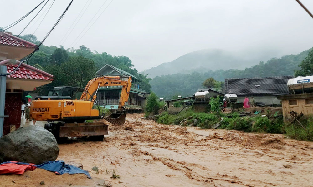
Flashflood ravages a town in central Nghe An Province in central Vietnam in September 2023. |
Based on observation data collected on the ground, including by rainfall gauges, the maps show the risk of inundation from heavy rainfall likely to occur every 10, 30, 50, 100 and 150 or 200 years, with the information to be used to facilitate smooth evacuation and community planning.
As Vietnam, Indonesia, Thailand and Cambodia are frequently hit by large-scale flooding, the ministry held that it would be useful for them to have similar maps that clearly show the risk of flooding in target areas.
Because the countries do not have sufficient ground-based observation data, the ministry decided to create maps of specific areas after simulating floods using observation data collected by the Global Satellite Mapping of Precipitation (GSMaP) system, operated by the Japan Aerospace Exploration Agency and others.
The ministry began discussions with the four countries in fiscal 2023 to select the target areas. It plans to provide a prototype version of the map to each country by the end of fiscal 2025.
In addition to preparing guidelines, which include procedures for creating maps, the ministry will also help develop human resources through training programs. The maps are expected to be made available to the public in each country.
As many Japanese companies operate in the four countries, the maps are also expected will help them draw up business plans in preparation for disasters and select their office or factory locations.
The ministry is also considering providing similar maps for other countries.


Source: VnExpress


Reader's comments (0)