Trami enters East Sea, becoming sixth tropical storm this year
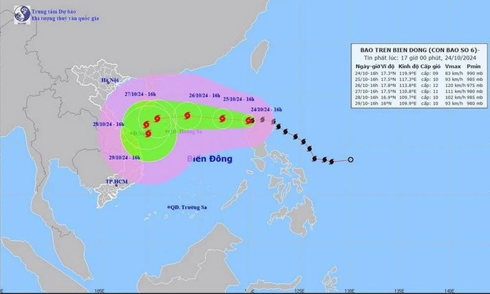
Tropical Storm Trami on October 24 afternoon entered the eastern part of the northern East Sea/South China Sea, becoming the sixth storm to appear in the sea so far this year, according to the National Centre for Hydro-Meteorological Forecasting.
As of 4:00 pm, the eye of the storm was located at approximately 17.3 degrees North latitude and 119.9 degrees East longitude in the eastern part of the northern East Sea. The velocity near its centre reached Category 9 (75-80km/h), with gusts up to Category 11, moving westwards at a speed of 15-20 km per hour.
 |
|
A map tracking Tropical Storm Trami. |
By 4:00pm on October 25, it is expected to continue westwards at a speed of 10-15km/h, still in the eastern part of the northern East Sea, about 610km east of the Hoang Sa (Paracel) archipelago. It will sustain the fastest wind speeds of Category 9-10, gusting up to Category 12.
Meanwhile, by 4:00pm on October 26, Trami is predicted to continue to track on a westward path at 15-20km/h, about 210km east-northeast of Hoang Sa. The strongest winds at that time will reach Category 11-12, with gusts of up to Category 15.
Due to its impact, the eastern part of the northern East Sea will experience strong winds at Category 7, later increasing to Category 8, with winds near the storm's centre reaching Category 9-10 (75-102 km/h) and gusts up to Category 12.
All vessels operating in the hazardous zones mentioned are likely to face thunderstorms, strong winds, and large waves.
In the Philippines, the widespread flooding and landslides caused by Trami left at least 24 people dead on October 24, swept away cars, and prompted authorities to scramble for motorboats to rescue trapped villagers.
 Bắc giang


Reader's comments (0)